As roads and highways infrastructure owners and managers can attest, practising and improving how they manage their assets is a journey that we are all on, in some shape or form. This journey can take many varied twists and turns (pardon the pun!) and relies increasingly more heavily on an organisation’s ability to identify and collect useful asset data, utilising technology to help inform us, so that we can make better decisions and deliver more effective and efficient programmes for our levels of investment.
We are all faced with the challenges of delivering an increasingly deteriorating asset condition and level of service with decreasing funds. The more capital investment we make in our infrastructure, the higher operation and maintenance burden it places on us to ensure our assets and networks deliver performance. Add in the increasing level of customer expectation for immediate information and response, competing priorities across the authority, scarcity of good, knowledgeable and experienced staff and suppliers and we quickly reach an unsustainable equation.
Every road authority’s journey is about discovering and implementing how to meet some of these challenges through the improvement of asset data collection, analysis and use of this information to determine more effective decisions to support the ‘six whats’ of asset management:
- What and where is the asset?
- What is it worth?
- What is the condition?
- What is its remaining service life?
- What maintenance is required and when?
- What should I fix first?
In the last decade in England, local authority road and highway services across the United Kingdom have been adopting a much more ‘fit for purpose’ solution to informing their decisions about these ‘whats’! From the beginning of 2010/11, the Department for Transport (DfT) required all 150 local highway authorities to annually provide detailed figures stating indicators of road condition, representing an overall measurement of percentages of road networks requiring maintenance. The outputs defined by the DfT necessitated a costly data collection activity, little of which was collected and presented in such a way to enable local authority asset managers to use this data to prepare forward programmes of work and develop practical prioritised maintenance and rehabilitation schedules. This resulted in many instances of the LA running parallel DfT reporting and programme development activities and data collection exercises, incurring additional costs and still not necessarily producing meaningful outputs.

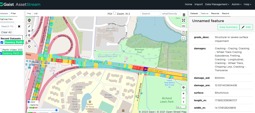
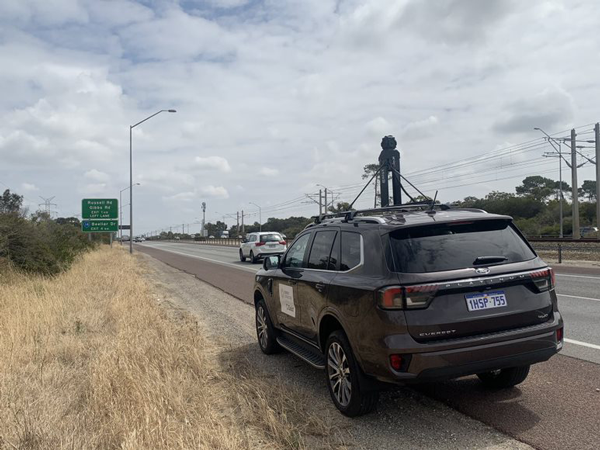
Working with these authorities to develop a more cost-effective and meaningful data approach, the Gaist Solutions Roadscape Intelligence Platform provided these road asset managers with timely annual inventory and condition data to address those ‘six whats’ and more importantly, to use that data to develop long-term practical and implementable forward programmes of work. The deployment of innovative camera technology, utilising the highest quality and cutting edge road imagery collection system allows our survey vehicles to capture and store the raw imagery on storage media on the vehicle as they operate. This raw imagery is automatically uploaded to our storage facility from anywhere in the world with internet access. The team post process the raw imagery to carry out quality assurance and create the final image files for automatic processing and manual quality validation.
Overview of the type and specifications of output data, including360deg image every 5m at 30MP stitched to 8k panorama jpg 4096×1000 pixel carriageway image every 1m. For certain features requiring advanced attribution, we use Artificial Intelligence (AI) to detect the features and inspectors to add or confirm attribution, maximising the capabilities of the most recent AI whilst ensuring good quality data and processing through manual checking. It utilises a flexible feature extraction pipeline, which enables provision of highly accurate outputs, cost effectively.
Working closely with asset owners and their asset management specialist partners, the team has supported the local authorities to make better decisions about future works, treatment types and frequencies, support business cases for additional investment and help inform elected members to better understand the existing condition of their road networks and the risks of carrying out or deferring critical maintenance and rehabilitation works.
More than sixty (60) local highway authorities across England now use this technology annually and also for additional services including asset valuations, strategic and tactical asset management planning and prioritised forward works programme creation to name a few.
This technology has now been introduced to Australia and New Zealand and we have already undertaken initial trials and condition surveys with the Main Roads Western Australia in Perth and currently working with Road Asset Management Contract Providers on the North and South Coast contracts in SE Queensland to develop a more cost-effective data collection process that has a proven and reliable engineering and technical process for condition assessment (aligned to the IPWEA Practice Note 9 Road Pavements Condition Assessment and Asset Performance Guidelines) and future works prioritisation based on assigned deterioration modelling parameters.
This technology and our services are now available for deployment on your network through the Essency Powered By Gaist partnership (Essency Consulting & Gaist Solutions). Please visit essencypoweredbygaist.com.au to learn more.


