
New Zealand has around 11,000 kilometres of state highway regulated by the New Zealand Transport Agency (NZTA) and about 83,000 kilometres of local roads administered by 67 councils.
On one level, the system is integrated because every road controlling authority in New Zealand uses the same asset management system originally created by the NZTA, but on another level there were inconsistencies and gaps in the data.
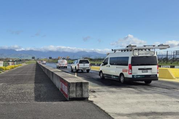
Sealed pavement condition assessment is crucial to effective asset management and data is key to condition assessment.
As Andrew McKillop told the audience at IPWC 2025, data collection practice varied widely across New Zealand’s 67 councils, with smaller councils facing particular challenges.
“More and more organisations were finding the old style visual inspections of roads were becoming more dangerous, and legislative requirements were making it problematic,” said McKillop, the programme director of the Road Efficiency Group (REG). REG is a collaborative partnership between NZTA, Local Government NZ and all road controlling authorities across New Zealand.
“We were finding that people were using incomplete or inconsistent data and that it was lacking in quality assurance, and some councils were not even collecting the right data or collecting any data at all.”
The response was an initiative called Consistent Condition Data Collection (CCDC), which aims to “develop national data standards, specifications, and methodologies to ensure consistent condition data collection, accuracy, processing and management.”
Funded through the National Land Transport Fund, the CCDC’s goal is to establish a national approach to data management and quality assurance to ensure consistency, and also undertake some of the data collection using modern technologies.
“It is absolutely critical that we get meaningful data that people can use for long term planning,” said McKillop.
“We have a nine year contract that enable us to be collecting data from main roads every year, tier two roads every second year, so within a short term we would have the data points so that people could do their short term, medium term and long term planning and modelling.”
Between September 2024 and July 2025 over 74,000 kilometres of local roads were surveyed with laser scanners supported by video, providing high quality surface condition data to councils across New Zealand.
All the data went through a series of quality assurance tests and validation before it was delivered to each council’s data base.
“Our service providers were able to use their own software to turn the information into usable information for councils,” said McKillop. “They carried out robust quality assurance and that was very successful, so with that we specified the laser and data standards.”
The raw data from the lasers is also stored, because over the course of the nine year contract it may be considered necessary or valuable to change algorithms, or technology, and in this event, it may be necessary to go back to the raw data.
“We are actually storing hundreds of terabytes of raw data, around 7 million data lines, and if need be we can extract that,” said McKillop.
A next step is creation of a centre of excellence between REG, councils and the wider sector to get even more value from the data, ensuring the data is used to full benefit. The centre of excellence will oversee data collection across state highway and local road contracts.
Further phases of the CCDC project include road strength, unsealed roads, and drainage features and structures data specification and collection.
“So we’ve got a partnership program, we have a government mandate, and we are collecting data across 67 councils in a long-term contract,” said McKillop.
“We’re releasing unbiased, functional data to 67 councils and we are bringing in state highway data collection contracts into our centre of excellence.
“We’re really focussed on the future and what we can achieve, given the confidence we have in the project after one year.”
At the time of the IPWC 2025 event in late August, McKillop said the contractors were having their vehicles calibrated with year two data collection to begin in September.
“So the future is also about how we might introduce LIDAR technology and AI across the video,”, he said.
“We believe that with the right data, the right analytics and the right program we can make the right decisions to deliver better outcomes for our communities.”
For more information visit: www.nzta.govt.nz


